Sharp-Healy Family
The Story of the first two Generations
Kyeburn
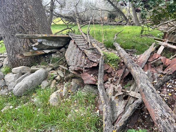
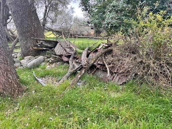
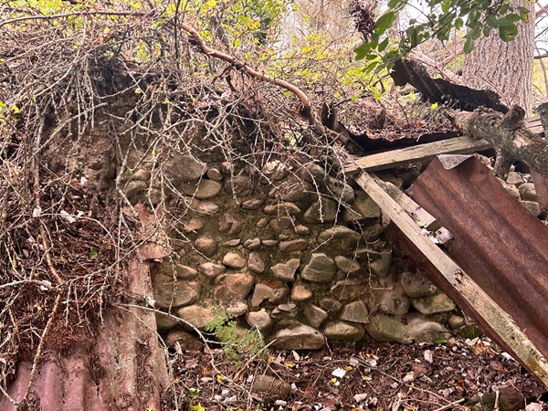
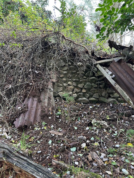
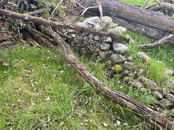
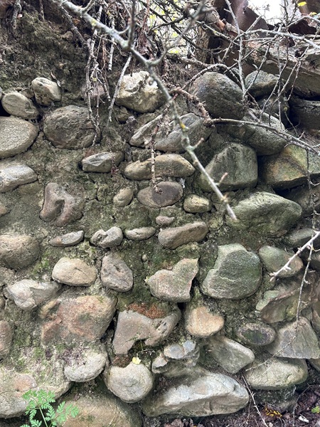
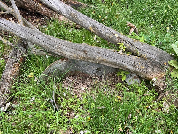
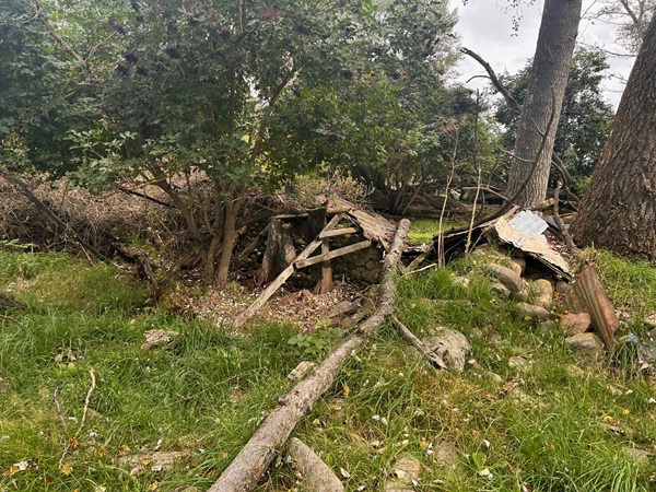
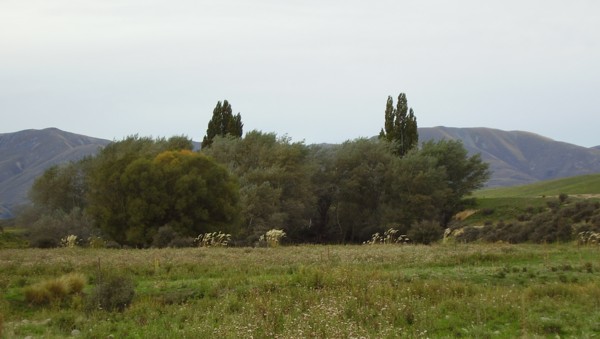
Kyeburn is where the Healy family lived for many years. The most notable location in the area is Healy's Trees. This is where Thomas and Margaret Healy built their home. It is now marked by a row of silver birch trees, hence the name Healy's Trees. The first picture below was taken many years ago by Eileen and the second picture was taken in April 2008 by Desmond Sharp.

 |
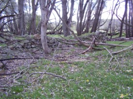 |
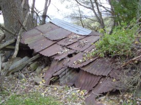
The photos above show the ruins of the Healy cottage and surrounding property stone walls. Taken by Desmond Sharp, April 2008.
History of the Kyeburn properties
The life and times of Thomas Healy has been documented in the pdf file Thomas Healy: Life and times on the Maniototo by Dale Hartle, 2026.
Lower Kyeburn
The Lower Kyeburn settlement area has virtually disappeared but the bridge over the Kyeburn River on State Highway 85 from Palmerston (known as The Pigroot), is a short distance away from the site of Maiseys Hotel which was the stopping point for Cobb & Co's coaches on their journey to Naseby and the goldfields in the interior of Otago. Once known as Cow's Corner because of the herds pastured there in summer, the only remaining evidence of the township are the Kyeburn School and the Hall and Library. While the School is now privately owned, the Hall and Library are both still in use. The Lower Kyeburn Cemetery is surrounded by trees and situated beside SH87 which leads to Middlemarch and the Strath Taieri.
Healy children who attended Kyeburn School were: Jeannie Healy 26/10/1888, Thomas Healy 28/9/1891, Rosann Healy 6/11/1893, Margaret Healy 1/10/1894, Fanny Healy 1/11/1894, Catherine Healy 7/12/1897, Susan Healy 13/9/1899, Patrick Parnell Healy 13/9/1899, and Denis Healy 17/09/1904.
Sharp children who attended Kyeburn School were: Eileen Sharp 3/3/1919, Joan Sharp 10/11/1919, and Doreen Sharp 12/5/1924.
Kyeburn Diggings
The Kyeburn Diggings goldfield was in existence even before the main finds at Naseby, gold being found there in 1861. Sluicing and dredging were the main mining methods with larger dredges working in the Kyeburn River until 1920. Hotels, stores, a butcher and a baker served the miners needs and a school opened in the mid-1860's, closing in 1935. Coal was also mined, providing the Maniototo with a good source of fuel until the railway arrived in Ranfurly allowing coal to be brought into the area. One of the few reminders of the settlement is the Upper Kyeburn Cemetery which sits silently alongside the road with prices for burial plots listed on a board.
References
Mackenzie, N.S. Gateway to Maniototo, A History of Kyeburn and Kokonga Districts, Compiled by N S MacKenzie ISBN 0-473-00882-3. Budget Print Ltd, 7 Bath St, Dunedin. Copy owned by Dale Hartle, and available from the National Library of New Zealand.
Maps
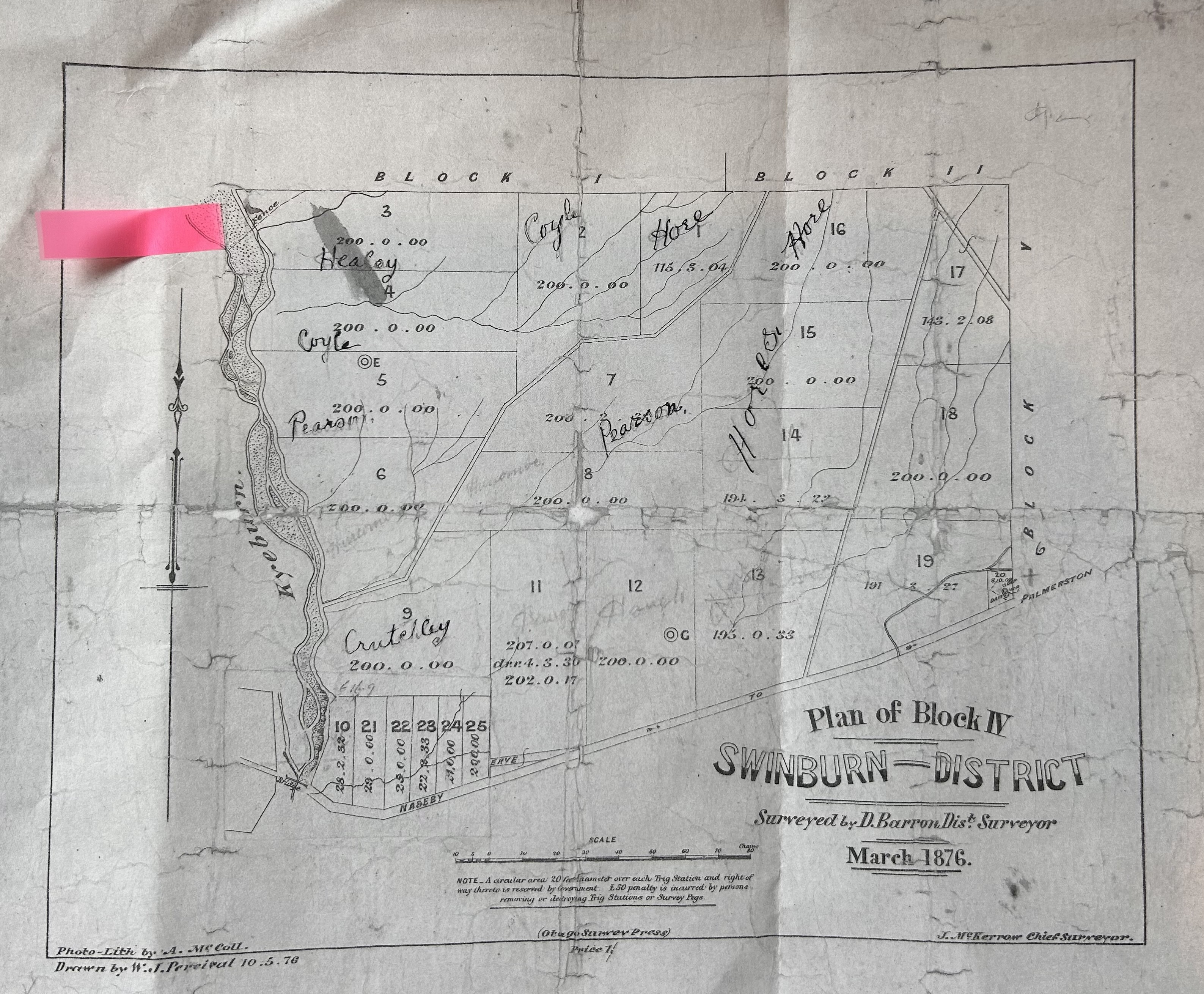
View an old map showing Section 3 and Section 16 with the name Healey and Hore.
View a Google map showing the exact location of Healy's Trees off Shea Road.
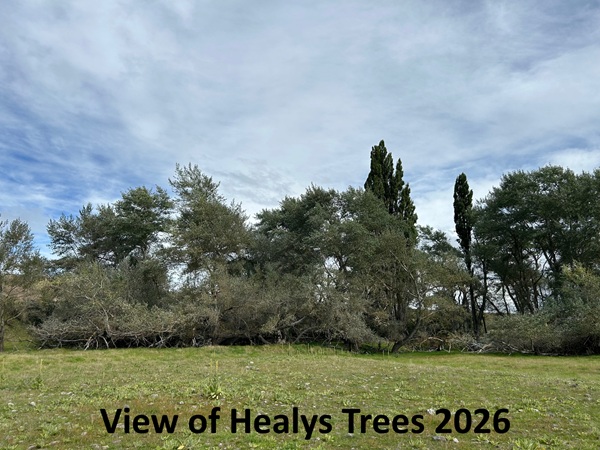
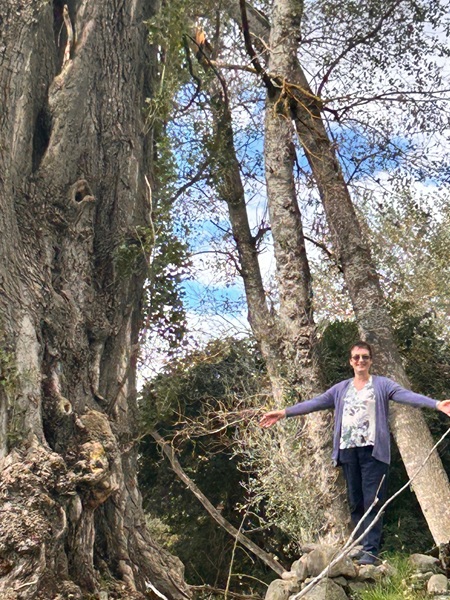
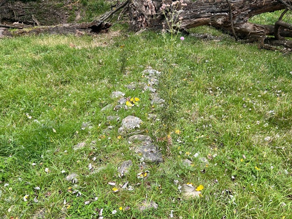
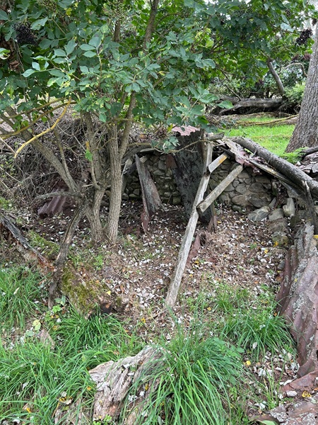
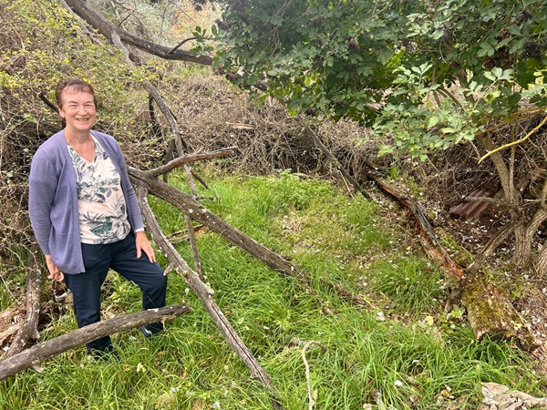
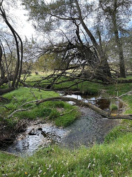
2026 Visit to Healys Trees
In early March 2026, Dale Hartle (great-granddaughter of Thomas and Margaret Healy) visited the location of Healys Trees, and took the following photographs. As you can see the area is pretty overgrown with long grass, fallen trees, and broken walls.